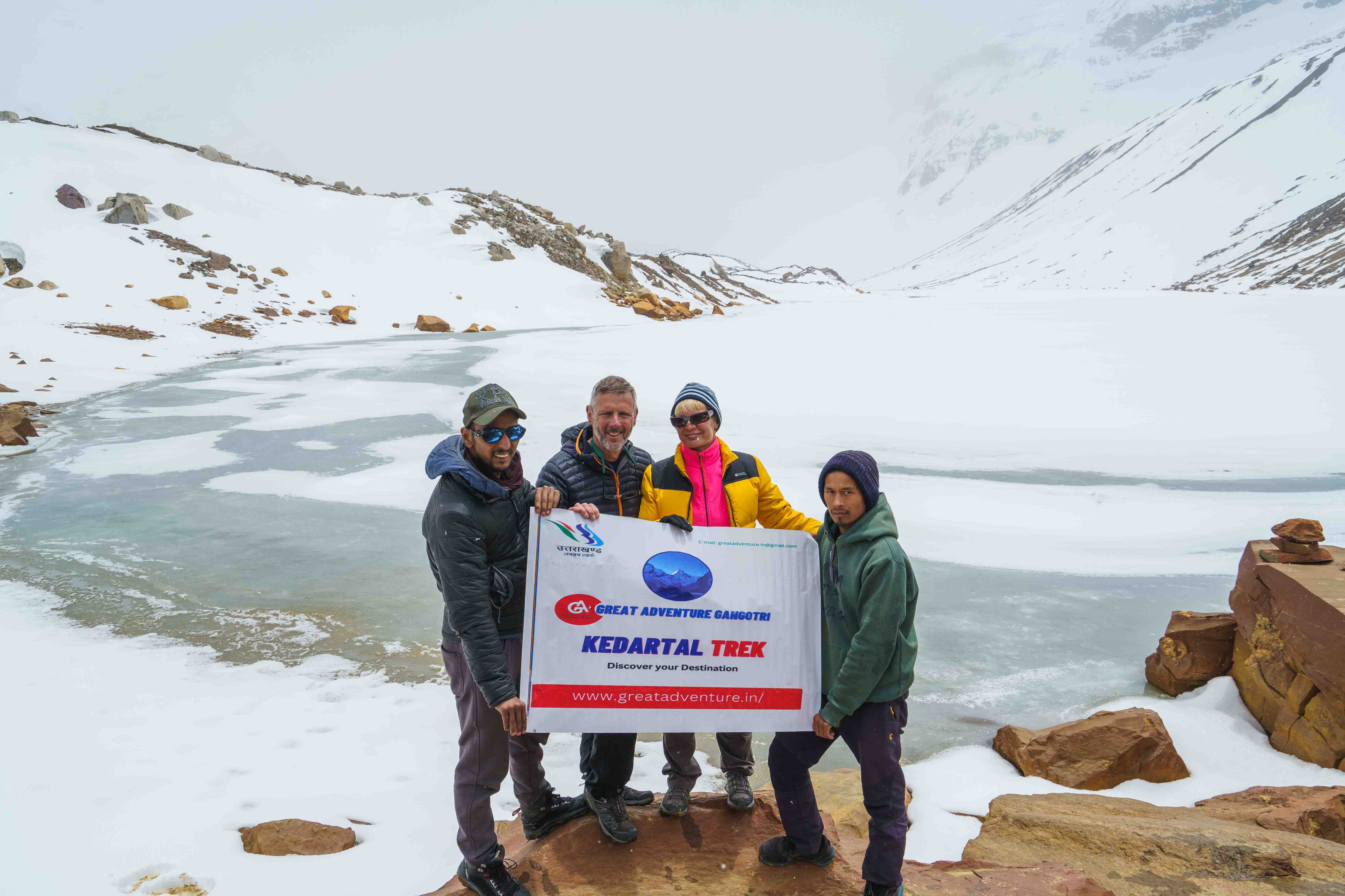
Kedartal Lake Trek
Kedartal Lake Trek: A Journey to the High Altitude Lake
···—
Kedartal Trek is a high-altitude trek that starts from Gangotri and takes you to the Kedartal Lake, which is situated at an altitude of 16,116 feet. The trek is known for its stunning views of the Thalay Sagar, Bhrigupanth, and Jogin group of peaks. The trek is considered moderate to difficult and requires a good level of physical fitness.
Trek starts from Gangotri, a popular pilgrimage destination, and takes you through dense forests, beautiful meadows, and streams. The Kedartal Lake, also known as the “Shiva’s Lake,” is surrounded by mountains, making it a serene and picturesque destination.
Introduction
Kedartal Lake Trek is a challenging trek that takes you through some of the most beautiful landscapes in the Himalayas. The trek starts from Gangotri, a small town located in the Uttarkashi district of Uttarakhand, India. From Gangotri, the trek leads you through dense forests, beautiful meadows, and rocky terrain to finally reach the Kedartal Lake. The trek takes about 6-7 days to complete, covering a distance of approximately 19 km.
Best Time to Visit Kedartal Trek
Best time to visit the Kedartal Trek is between May and June and September and October. The weather during these months is pleasant, with clear skies and moderate temperatures. The monsoon season between July and August is not recommended as the trail becomes slippery and the risk of landslides increases.
Kedartal Trek Route
Kedartal Trek can be reached by air, train, and road. The nearest airport is the Jolly Grant Airport in Dehradun, and the nearest railway station is the Dehradun Railway Station. From there, you can take a taxi or a bus to reach Gangotri, which is the starting point of the trek.
Kedartal Trek is a 19 km trek that starts from Gangotri and takes you through lush green forests, rocky terrain, and snow-covered mountains.
Difficulty Level of the Trek
Kedartal Trek is a difficult trek and requires a good level of fitness and preparation. Trek takes you through challenging terrain, including steep ascents and descents, rocky paths, and glacial streams. The high altitude of the trek also makes it challenging, and trekkers may experience altitude sickness.
Gallery
Inclusions:-
2. Meals while on trek (Veg.) (Dinner on day 1 to Breakfast on day 7)
3. Equipments: Sleeping bag, mattress, tent , toilet tent, utensils
4. All necessary permits and entry fees.
5. First aid medical kits, stretcher and oxygen cylinder.
6. Mountaineering qualified & professional trek Leader, guide and Support staff.
7. Transport from Rishikesh/Dehradun and return
8. Mules to carry the central luggage
Exclusions:-
1. Any kind of personal expenses.
2. Food during the transit.
3. Insurance
4. Mules or porter to carry personal luggage.
5. Anything not specifically mentioned under the head.
6. Any kind of emergency evacuation charges.
Note : Charges of offloading backpack:- INR 1800/- The backpack cannot weigh more
than 10 kgs.
Cancellation Policy
Cancellations prior to 30 days from the start of the Trip
a. Get 95% refund
B. 100% cash voucher for any trip till one year
Cancellation between 30 days and 15 days to the start of the Trip
• Get 70% cash refund
• 100% cash voucher for same trip till one year
• 80% cash voucher for any trip till one year
Cancellation less than 15 days to the start of the trek
• No refund
Itinerary
Day ( 1 ) Rishikesh to Uttarkashi ( Drive 168 km / 5.6 hrs / 1,158 mtr )
EXPLORE TO UTTARKASHI
- Explore to Vishwanath Temple.
- Overnight stay in hotel.
Day ( 2 ) Uttarkashi to Gangotri ( Drive 100 Km / 5.6 hrs, / 3,048 mtr )
VISIT TO GANGOTRI
- Along the road from Uttarkashi to Gangotri passes through the Harshil valley. Keep your eyes open to see many famous places. You know that Gangotri is the birthplace of Mother-Ganga, it is one of the Dhams of Char Dham Yatra. Gangotri is situated on the banks of Bhagirathi River at an altitude of 3,048 meters.
- Overnight stay in hotel.
Day ( 3 ) Gangotri to Bhoj Kharak ( 8 km / 6.7 hrs / 3,930 mtr )
THE TREKKING TRAIL
- Get up early and move on to the actual trekking path. The trail is 8-9 km long and unique. Today, the road to Bhoj Khadak is different. Most of the way is rocky and this is the only way to reach Bhoj Khadak. So we will go together and Kedar Ganga will always remain bye. And you will find Bhojpatra trees in abundance. It is believed that husks were used to write ancient writers. The path becomes narrow as you proceed. Once you cross this risk patch, you will reach Bhoj Kharak. This camp is lined by Bhoj trees, purple rhododendron. besides the view of Mount Thalayasagar makes it an ideal camp.
- Overnight stay in tents.
Day ( 4 ) Bhoj Kharak to Kedar Kharak ( 7 km / 5.6 hrs / 4,410 mtr )
CLOSE VIEW OF MOUNTAIN RANGES
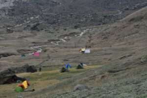
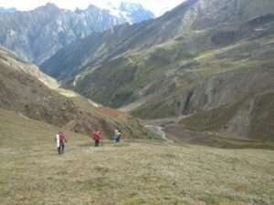
- Today the hike is less compared to yesterday although the trail begins with a steep uphill first. As you go up the treeline starts disappearing. then the path opens to the meadows full of colorful flowers. After yesterday’s rocky terrain, today there will be a pleasant walk with some ups and downs. Bharal or blue sheep and various types are known to be sighted. That’s why keep your eyes and ears awake. The campsite is situated amidst the meadows. Where amazing views of Brighupanth peak are visible. You will reach the campsite after crossing one last river over Kedar Ganga. Do not miss to watch the famous sunset from this place.
- Overnight stay in tents.
Day ( 5 ) Kedar Kharak to Kedar Tal ( 4 km / 5.6 hrs, / 4,859 mtr )
VIEW OF MOUNTAIN
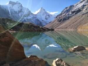
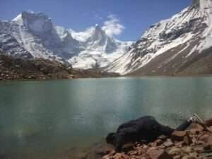
- There is another 4 km long trek from Kedar Khadak to reach Kedar Tal. Which is mostly moraine and glacier.If you are trekking in June then you may have to trek on snow for the last few kilometers before reaching Kedartal.Cross the river over icy cold water and climb steep rocky terrainTo make sure you are on the right track.After climbing the last ridge, the view of other lakes including Kedar bamak Glacier. becomes clear from a distance.The merger of the Bhrigupanth mountain and the Thaliasagar mountain. With the Kedar bamak glacier is a breathtaking sight.Continue trekking for another hour to witness. the spectacular views of the immaculate Kedar Tal, a high altitude lake.The view of Thalisagar peak reflecting on the calm waters of Kedartal is mesmerizing.Kedar Tal is situated at an altitude of 4,859 meters above sea level.Explore Jogin Advance Base Camp and leave Kedartal around noon and trek towards Jogin (4,900 m).Not only will this hiking acclimatise you. well, but it will also offer excellent views of the Thalayasagar Peak. its West Ridge opening, and you will see the Talayasagar Icefall up close.
- Afterwards, trek back to Kedar Kharak and stay overnight in the tents.
Day ( 6 ) Kedar Khadak to Gangotri ( 15 Km / 8.9 hrs / 3,048 mtr )
BACK TO GANGOTRII
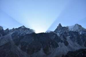
- Capture the breathtaking sunrise views of Kedar khadak early in the morning. and then head out to enjoy the long and tiring journey to Gangotri, which will take around 6-7 hours.
- Overnight stay in hotel.
Day ( 7 ) Gangotri to Uttarkashi ( Drive 100 Km 5.6 hrs / 1,158 mtr )
- Will have early breakfast and leave for Uttarkashi. and drive to Uttarkashi / Rishikesh via Harshil Valley.
- Departure day.
Booking form
Experience
Similar Trek
Kedartal Trek with Great Adventure Gangotri
Contact us for planning your Kedartal Trek with best travel packages of as per your requirements!
EVENTS BY DURATION
- 1 Night
- 2 Night
- 3 Night
- 4 Night
- 5 Night More..
Contact Us
- Gangori Gangotri road Uttarkashi Uttarakhand 249193
©2023. greatadventure.in All Rights Reserved.

